Manage your site
with confidence

We connect people to their project sites through a smart online platform, giving them
total control, visibility and confidence for efficient site management.

Have you been frustrated by

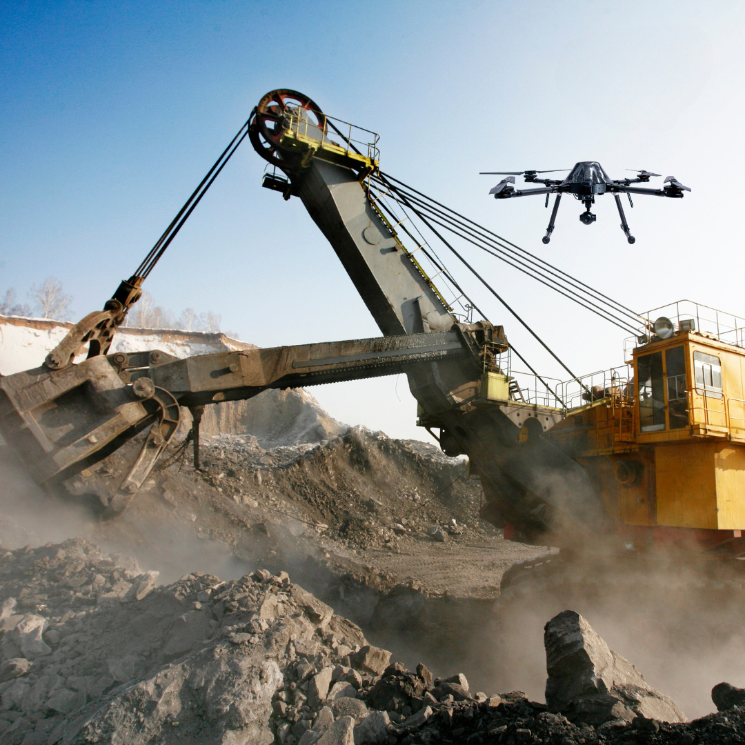
Lack of complete visibility of your project sites (construction, farms, mines, forest, etc..)

Poor project documentation and records resulting in dispute with client

Verifying contractors/ subcontractor work against the agreed workplan and design.

Poor survey measurements for BoQ

Contractor or subcontractor who execute work poorly resulting in cost overruns and project delays

Keeping all stakeholders engaged and up to date.

Industries

No matter where you are, manage your site with ease any time

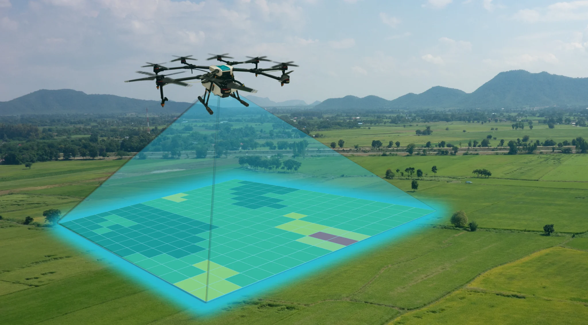
Data Quality guaranteed

Automated drone data collection ensures fast, high-quality, and actionable site information within minutes, not days or weeks

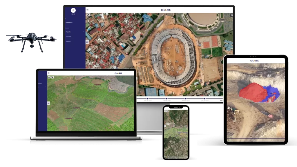
Easy Access To Your Site

Track site progress, receive reports, tips, and address issues anytime, anywhere with the Charis analytics platform, available 24/7

Make Your Stakeholders Happy

Experience faster and more reliable site management, boosting efficiency, minimizing risks, and ensuring your stakeholder satisfaction

0 +

People Impacted

0 +

Number of flights

0 +

Countries covered

0 Hrs +

Of flights times

0 +

Covered Hectares

0 +

Terabytes Processed

Recognition Received

ITU TELECOM WORLD

 RECOGNITION OF EXCELLENCE

FORBES 30 UNDER 30

CLASS OF
2019

London Stock Exchange Group

Companies to Inspire Africa 2019

Google for Startups

Black Founders
Fund

Trusted by

How it works

Discover Your Needs

First, we conduct a 15 minute free consultation meeting to determine your specific needs at your worksites, ensuring we understand exactly what you’re looking for.

Design Your Plan

Second, we’ll develop a customized plan for regular automated drone data collection and processing. This plan will be tailored to your specific needs and will ensure That you get the data you need to make informed decisions about your worksite project.

24/7 Access to Your Worksite Data

Once we’ve collected and processed the data you’ll have 24/7 access to it through our online platform, Charis Analytics. No matter where you are or what time it is, your data is a ways at your fingertips

Projects Adopted Charis Analytics Communication Platform

Amahoro Stadium
Amahoro National Stadium
Bugesera International Airport
Inzovu mall
Inzovu Mall
KGC
Kigali Green Complex (KGC)
Kigali Financial square
Kigali International Finance and Business Square by Equity Bank
Zaria Court
Zaria Court

Here What Our Customers Say

HASSAN A. HASSAN CEO, ADHI

For Bwiza Estate in Kigali, Charis delivered a high-accuracy topographic survey before design and construction. Then Charis Analytics took monitoring to the next level with clear, month-to-month aerial proof of progress. It kept everyone aligned and made decision-making much easier.

MOHAMAD SAFA Operations Manager, ACTS

For the runway rehabilitation at Kigali International Airport, we needed a high-accuracy topographic survey we could rely on. Traditional ground surveys for this scale can take 4 to 6 months. Charis completed the full survey in under 4 weeks with precise elevation data. That speed and accuracy helped our engineers move into design without delays or costly errors.

DN.JIMMY JOHN SIMON Administrator, Believers Hospital Legal Representative, Believers Eastern Church

Our hospital construction project required transparent and credible documentation of progress for stakeholders and benefactors. The aerial photography and videography provided by Charis offered a comprehensive, real-time visual overview of the entire site. This significantly strengthened donor confidence and encouraged continued financial support for the project.

JEAN MARCEL UWAREMWE MD, Build Smart

For our 160-hectare site in Bugesera, we needed a topographic survey we could trust for future urban development. Charis delivered accurate elevation data, contours, and 3D terrain models fast. Having the outputs inside Charis Analytics made planning simpler. We could see the land clearly and make better decisions on roads, drainage, and utilities.

Laure Mbabazi

Charis Analytics has significantly improved trust between us and stakeholders and enhanced our ability to manage projects, especially with those not located in Rwanda. It simplifies our weekly check-ins by providing reliable data on project status and is essential for our record-keeping.

Claudine Niyonsaba

Drone spraying in our swamp transformed our business. Mosquitoes vanished, customer loss stopped. Now, we stay open until 22:00, boosting income. No more mosquito worries for customers after 19:00

Emmanuel Harerimana

Drones curbing mosquitoes transformed our farming. Reduced mosquito presence enhances work hours, boosts productivity. No more worker absences from malaria. Farming now extends till late evening, ensuring prosperity.

Scroll to Top