For the first time in Rwanda, Charis UAS has introduced new technology for mapping and surveying: LIDAR. Light Detection and Ranging (LIDAR) technology offers multiple advantages over traditional methods for representing terrain surfaces such as high vertical accuracy, advanced resolutions, and time and cost efficiencies. The technology uses millions of georeferenced point clouds to represent each feature of the terrain with maximum precision.
HARNESSING THE 3D LIDAR POINT CLOUD
LIDAR is a laser scanning remote sensing technique. As it is non-invasive, it is especially suited for topographic surveys of vegetation, rugged, or hard to access zones. The LIDAR surveying method has helped surveyors to shift from the exhausting practice of mapping with heavy Differential GPS tools & ETS (Electronic Total Stations) to the time-saving method of utilizing UAVs/drones equipped with high powered technology.
LIDAR cameras can collect more than 200 points per square meter in less than a second for medium to huge and complex sites. The density of LIDAR point clouds allow for the generation of high-resolution 3D models, Digital Terrain and Surface Models (DTM & DSM) of less than 5cm. Additionally, a UAV with a LIDAR camera flying in Real-Time Kinematic (RTK) systems allows the point clouds to have a great accuracy of less than 1cm RMSE (Root Mean Square Error). Due to the excellent accuracy of the LIDAR point cloud, this technology is dominating the traditional topographical survey space.
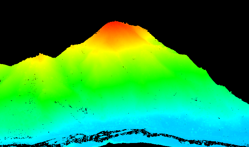
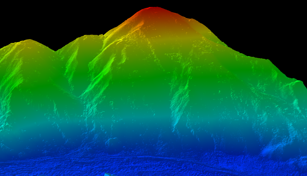
CREATING A 3D MODEL OF A TERRAIN
The uniqueness of using LIDAR lies in its ability to generate extremely precise 3D models of any terrain. The LIDAR DTM is a terrain model of the earth’s surface with ground cover features, with other attributes such as buildings and vegetation cover removed. LIDAR is capable of penetrating into the vegetation canopy, targeting the ground surface.
At Charis UAS, we apply algorithms combined with visual and manual editing of the data to produce an accurate model of a surface. This is done when we want a map to represent the terrain of dense land with vegetation cover.
Producing a model such as this allows surveyors to better understand the terrain and make more informed decisions on their projects.
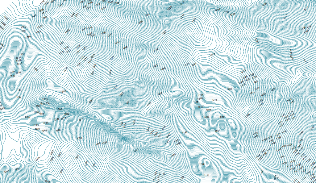
ACCURATE CONTOUR LINES IN TERRAIN MODELS
Traditionally, contour lines can be generated by manual surveying or photogrammetric methods. However, despite their common use, these methods are expensive and lack efficiency. Furthermore, the accuracy of the contour lines generated is not high enough in some areas that contain densely vegetation covered forest or feature hard-to-access zones.
One of the primary uses of the LIDAR system is for Digital Elevation Model (DEM) acquisition with a reasonably high accuracy in contour line generation from LIDAR data filtering. This involves distinguishing ground from non-ground points and facilitates the generation of highly accurate contour lines as any simple variation in elevation is measured and represented by a point.
Mapping that showcases more accurate contour lines can save time and energy when it comes to deciphering the features of a large swathe of land.
SOLVING AFRICA’S BIGGEST CHALLENGES
With our help, forward thinking countries like Rwanda are quickly adopting this new generation of active surveying techniques to improve national development and solve some of their greatest technical challenges.
If you’re interested in how our services can help support your project, contact us at
+250788386081 / +250781186614 or info@charisuas.com.