Why Engineers Trust Charis When the Stakes Are High
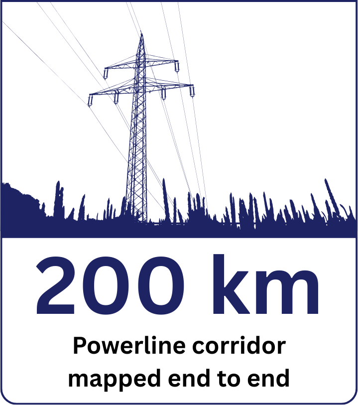
Mapping a 200 km powerline corridor isn’t just a survey job. It’s a race against project timelines, a battle with difficult terrain, and a test of whether your data partner can actually deliver when everything is on the line.
The terrain didn’t care about deadlines. Dense vegetation. Steep ridgelines. Remote access points. Traditional survey methods were impractical and slow. Every week of delay meant engineering decisions stalled, budgets stretched, and project momentum lost.
That’s where Charis came in.
Using high-precision drone surveys, battle-tested aerial data workflows, and our proprietary Charis Analytics, we captured, processed, and delivered design-ready terrain data across the full 200 km corridor in weeks, not months.
No compromises on accuracy. No surprises on delivery.
This is the story of how it happened and what it means for infrastructure projects that can’t afford to wait.
Rwanda’s 2030 Deadline Isn’t Waiting: Rwanda has set one of Africa’s most ambitious energy targets: 100% electricity access for every household by 2030. With the national grid currently reaching just over 59% of homes, the remaining gap must be closed in years not decades. That means hundreds of kilometers of new powerline infrastructure, cutting through some of the country’s most challenging terrain.
The bottleneck isn’t ambition. It’s speed. Traditional ground surveys are too slow, too expensive, and too risky for the scale of deployment Rwanda needs. Every week lost in the survey phase is a week delayed in design, procurement, and construction.
This 200 km corridor project is proof that a faster, more reliable path exists and that it works at scale. If Rwanda is serious about hitting 2030, drone-based terrain surveys shouldn’t be an option on the table. They should be the standard.
THE CHALLENGE
A corridor dataset engineers can trust. Across seven districts.
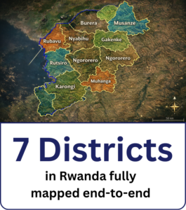
Before design could move forward, the team needed one consistent terrain dataset for the full 200 km corridor across Bugesera, Nyanza, Ruhango, Rubavu, Nyabihu, Ngororero, and Gisagara districts. Route alignment, tower locations, and vegetation clearance decisions all depend on this baseline dataset.
Using traditional ground surveying, this corridor would typically be measured in sections with Total Stations and Global Navigation Satellite System (GNSS) Real-Time Kinematic (RTK) rovers. On long routes, that approach becomes slow and expensive to coordinate.
It often requires recruiting multiple survey crews, moving them across difficult terrain, and stitching data from many segments into one model.
There is also a quality risk. Total Stations require a clear line of sight. GNSS can degrade under tree canopy when signals are blocked or reflected, sometimes causing “multipath” errors. When data arrives late, or when sections do not match perfectly, design teams either wait or design using assumptions. That is how small survey gaps turn into redesign, schedule slips, and clearance surprises during construction.
For this specific project, the traditional approach was estimated at 4 to 6 months. The project needed a faster path to a clean, corridor-wide dataset that design teams could rely on.
THE SOLUTION
Drone LiDAR corridor mapping. Processed into one design-ready dataset.
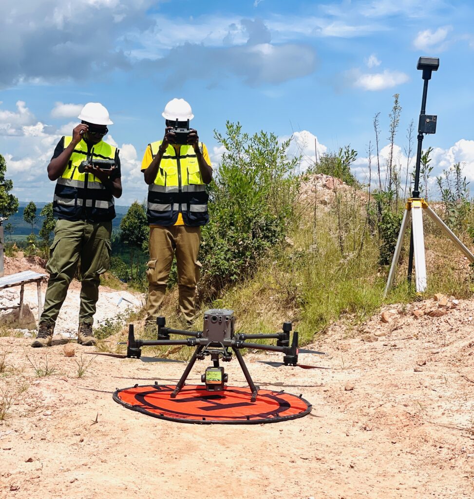
 Charis Analytics captured the corridor using LiDAR (Light Detection and Ranging) equipped drones and processed the data into one continuous 3D dataset that stayed consistent from district to district. LiDAR records dense 3D measurements along the route, which supports reliable terrain modeling and vegetation clearance analysis at corridor scale.
After capture, we ran structured processing and quality checks to classify the point cloud into ground and non-ground features. From that, we produced engineering deliverables used in corridor planning and design, including:
- Digital Terrain Model (DTM). Bare-earth ground surface for engineering decisions
- Digital Surface Model (DSM). Top surface including vegetation and structures
- Digital Elevation Model (DEM). Design-ready elevation surface for route planning
- Vegetation height and clearance layers. For right-of-way and safety review
- 3D corridor model. A shared visual baseline for team reviews
The goal was simple. Give the project one trusted dataset early, so design decisions are made from measurements, not stitched segments and guesswork.
THE OUTCOME
Design-ready corridor data delivered in 4 weeks, from one consistent baseline
- 200 km corridor mapped end to end across 7 districts in Rwanda
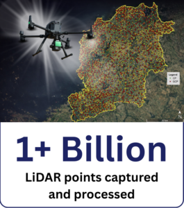
- 1+ billion LiDAR point-cloud records captured and processed into a single corridor-wide dataset
- Engineering design inputs delivered: DTM, DSM, DEM surfaces, plus vegetation height and clearance layers and a 3D corridor model
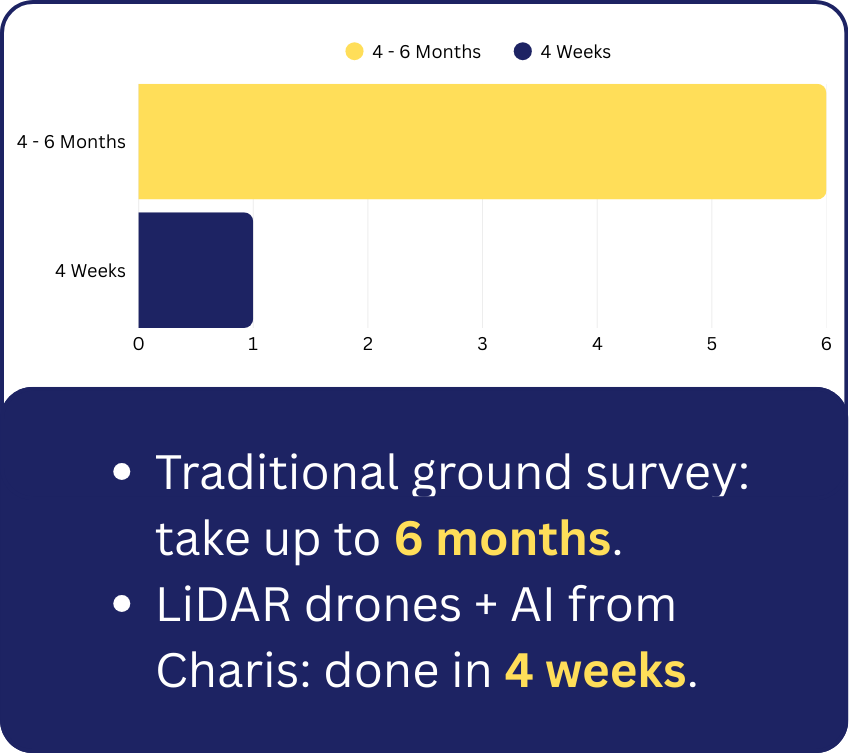 Traditional ground surveying for a corridor of this scale was estimated at 4–6 months. Charis compressed that timeline because collection is one part of the job, but processing is where delivery is won.
Charis processed the dataset using a state-of-the-art geospatial processing farm powered by advanced high-performance machines and GPU-accelerated workflows, enabling rapid turnaround while maintaining strict QA/QC and consistent output quality.
This was delivered by Charis UAS’ senior technical team, bringing 50+ years of combined experience executing large-scale topographic and infrastructure mapping projects across Africa.
With a corridor-wide baseline in place, the design team kept route planning moving, reduced delays caused by missing sections, and lowered the risk of downstream redesign triggered by inconsistent early data.
Ask us about LiDAR topographic surveying for your next infrastructure project.