How Charis UAS Surveyed 5,000+ km², Delivering Centimeter-Level Accuracy Across Nine Districts


- 60+ billion LiDAR data points captured and processed
- 100+ terabytes of data LiDAR and imagery datasets managed end-to-end
- Centimeter-level vertical accuracy achieved
- Complete engineering-grade geospatial intelligence package delivered on time
In 2024, Charis UAS executed Rwanda’s largest LiDAR mapping mission, producing the first complete, high-precision terrain baseline for the entire Volcanoes Region.
THE CHALLENGE
Build one trusted dataset at national scale
The Volcanoes Region spans Burera, Musanze, Nyabihu, Rubavu, Gakenke, Rutsiro, Ngororero, Muhanga, and Karongi districts. It is defined by steep volcanic ridges, dense forest canopy, wetlands, and complex drainage systems that demand precision planning.
Before this mission, no single, unified terrain dataset existed across the full 5,184 km². Infrastructure, environmental, and watershed planning relied on fragmented or inconsistent data, increasing the risk of design assumptions and downstream rework.
The mandate was clear: deliver one seamless, centimeter-level dataset across nine districts that could support engineering and institutional decisions without stitching errors or inconsistencies.
At national scale, projects do not fail in the air. They fail in processing.
Processing over 60+ billion LiDAR data points requires production systems built for scale, strict QA/QC discipline, and structured geospatial data pipelines. Without that foundation, large-area mapping quickly becomes misaligned, inconsistent, and unreliable.
This project demanded more than aerial capture. It required industrial-grade data management, processing precision, and execution discipline from start to finish.
THE SOLUTION
Industrial-scale data capture and processing.
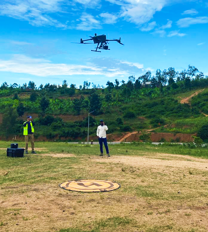
Charis deployed a multi-platform acquisition strategy combining:
- Helicopter-based LiDAR for large-area coverage
- High-precision RTK and PPK drone systems for constrained zones
- Supplementary satellite inputs where required
Instead of delivering stitched segments, Charis engineered one unified dataset that behaves as a single survey across 5,184 km² and nine districts.
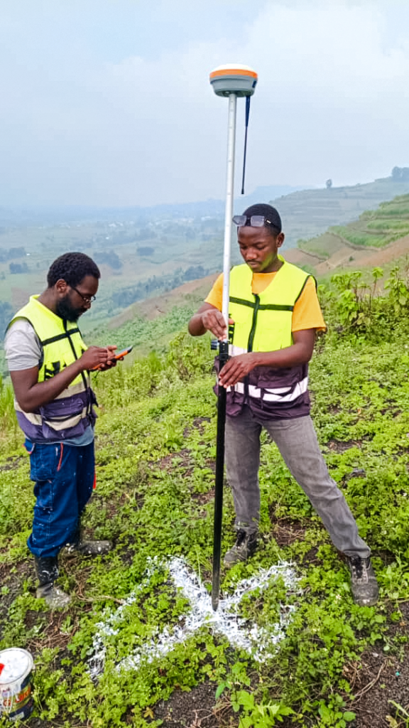
Ground control networks anchored to Rwanda’s national CORS framework ensured centimeter-level positional integrity across the full project footprint.


The true differentiator was processing capacity.
This mission generated multi-terabyte LiDAR and imagery datasets representing more than 60+ billion individual LiDAR data points.
Charis executed the full workflow through a block-optimized production pipeline designed for national-scale geospatial intelligence programs.
The process included:
- LiDAR alignment and calibration
- Automated and manual point cloud classification
- RGB and NIR orthophoto production
- AI-assisted land cover modelling trained on tens of thousands of high-resolution image tiles
- Systematic validation before final packaging
Deliverables included:
- Classified LiDAR point clouds
- Digital terrain and surface models
- Canopy height layers
- High-resolution orthophotos
- Land cover datasets
- Drainage and basin layers
- Contours and breaklines
- A complete digital basemap ready for institutional deployment
This mission was delivered by Charis UAS’ senior geospatial leadership team, bringing 30+ years of combined experience executing national-scale topographic and infrastructure surveys across Africa. Complex terrain, high data volumes, and multi-platform integration are environments where Charis operates with confidence and precision.
THE OUTCOME
Rwanda’s most comprehensive Volcanoes Region terrain baseline

The result is a single, consistent geospatial foundation that technical teams can use across the Volcanoes Region without second-guessing the data.
For government and institutional users, that unlocks real decisions:
- Flood and runoff modelling built on reliable elevation
- Drainage and watershed planning with consistent catchments
- Infrastructure routing and design with accurate terrain context
- Environmental and forest monitoring with repeatable baselines
- Faster planning cycles with fewer site resurvey loops
This was not just a mapping exercise. It was the creation of a regional baseline built to hold up under scrutiny.
ENGINEERED FOR NATIONAL-SCALE DELIVERY
Charis UAS is a leading geospatial data company delivering high-precision mapping, analytics, and digital terrain intelligence for infrastructure, environmental management, and public-sector planning.
Charis is engineered for projects where scale, data volume, accuracy, and delivery timelines are non-negotiable, and where processing capability matters as much as capture.
If your institution is planning infrastructure, environmental resilience, or national development programs, partner with a team proven to deliver terrain intelligence at national scale.